- HOME
- BEFORE YOU GO
- Weather on the Pacific Coast Highway
Weather on the Pacific Coast Highway
What is the weather on the Pacific Coast Highway like, when you're planning a drive along the Pacific coast?

It helps to know what the weather on the Pacific Coast Highway is likely to be like, when you're planning your drive along the Pacific coast.
Best Times to Visit
Best Time to Visit Los Angeles
Best Time to Visit the Olympic Peninsula
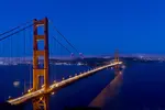
Best Time to Visit San Francisco
If you're planning on driving the whole Pacific coast then you're looking at a distance of about 1500 miles, give or take. The weather on the Pacific Coast Highway in the north, in Washington State, is obviously going to be very different from the weather at the other end, in southern California.
If your aim is just to drive the coast from either San Diego or Los Angeles to San Francisco, or the other way round, then the weather is going to be a bit more consistent. Even so, weather is unpredictable from one year to the next. This is also the coast, and coastal regions like mountainous areas are notoriously difficult to predict.
We can give you some guidelines, though, on what's likely to happen with the weather on the Pacific Coast Highway, to help you plan your trip.

Which Direction?
If you plan to travel in the spring and drive the whole coast then drive from south to north, in the hope that the weather in the north warms up a little by the time you get there. If doing the same thing in the fall, drive north to south.
If you're only doing the California stretch then it doesn't really matter, but if you drive north to south you're on the coastal side so you get slightly better views. It's also easier to pull off for the best coast-side viewing areas, and to pull back on again.

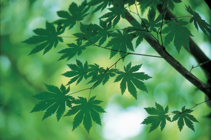
California PCH Weather
Although the song says it never rains in southern California, it would be truer to say it never snows in southern California. Well, hardly ever. There are occasional freak exceptions. But the further south you go, the less chance there is of rain.
San Diego
Taking the southernmost big city, San Diego, from November through to March you will probably only see 4-6 days per month on which it rains. In July and August there might be one day a month on which it rains, and in other months there is very little rain indeed.
In January San Diego's high temperatures average about 66F (19C), but it does get chilly at night, with average lows at about 45F (7C). You'll get an average of 8 hours of sunshine, but sea temperatures are only about 59F (15C), so not too warm. By May you're down to 2 rainy days and average highs of 70F (21C), very comfortable for sightseeing, with night temperatures averaging 55F (13C).
September is another good month to travel
to San Diego, with the likelihood of only one rainy day and highs averaging 79F
(26C). The sea temperature has also now warmed up to 68F (20C). October is similar, so if you plan to do lots of swimming make your trip in the fall. August is the
hottest month with average highs of 75F (24C).
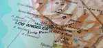
Los Angeles
The weather in Los Angeles is very similar to San Diego. There is even less rainfall in summer, and temperatures are a touch hotter, but otherwise you can expect more or less the same.
San Francisco
San Francisco is about 500 miles north of San Diego so you can expect the climate to be cooler and wetter. In December-January expect an average of 10 days on which you'll get some rainfall, with maximum temperatures at about 55F (13C). At night this will drop to 45F (7C) or so.
In May San Francisco only gets an average of 3 rainy days, there will be 11 hours of sunshine but temperatures are still only a modest 64F (18C) maximum average. At night it will be about 50F (10C).
September is a good month in San Francisco,
with only 2 rainy days and high temperatures now averaging 72F (22C), and 55F
(13C) at night.
In both July and August there will likely only be one day on which it rains. Average highs are 68F (20C), so good sightseeing weather. You'll get an average of 10 hours of sunshine per day, while at night it will be 54-55F (12-13C).
Oregon PCH Weather
To give you an idea of typical weather on the Pacific Coast Highway in Oregon, let's take Depoe Bay as an example. In December and January there will on average be 18 days in the month when you'll see some rain. The average maximum temperature will be just 54F (12C), and the average minimum down to 41F (5C).
In May there will still be 10 rainy days, with temperatures of 46F (8C) for average lows and 61F (16C) for average highs. In October it's 11 days of rain, average lows of 48F (9C) and average highs of 63F (17C).
The best weather in Oregon is in July and August, which average just 3 rainy days each month, with average highs of 68F (20C) and lows of 54F (12C).
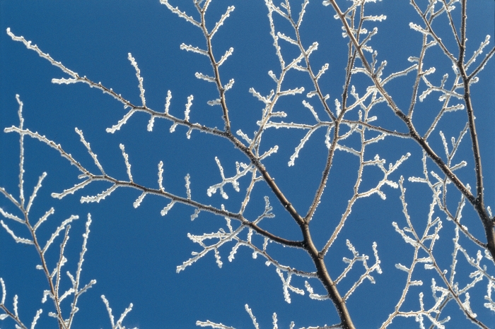
Washington State PCH Weather
We wouldn't recommend driving the Pacific Coast Highway in Washington in winter. You could be lucky and get dry weather and crisp days, but it can also snow and be generally wet and cold. To take Seattle as an example, in a typical January there will be 18 days on which you get some rain. The average maximum temperature is just 45F (7C).
By April Seattle will be down to 13 days with some rain, with the maximum temperatures up to 57F (14C).There's now an average of 7 hours of sunshine daily.
July and August sees Seattle's maximum temperatures averaging 75F (24C), and in June and September they average 70F (21C). July sees the least rainfall with just 5 rainy days on average.

Winter Storms
Details of average temperatures and rainy days only tell part of the story, of course. One reason for avoiding the Pacific Coast Highway in winter, even in southern California, is the risk of winter storms.
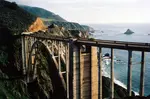
There have been some violent storms in recent winters, and the highway sometimes experiences mudslides. Sometimes these are minor and get cleared away quickly, but in 2017 there was a very heavy mudslide south of Big Sur and that stretch of the highway was closed for well over a year.
The area around Santa Barbara has also experienced bad storms in recent years, so it's best to drive the highway in late spring at the earliest, to minimize your bad weather risk.

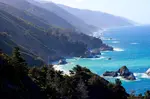
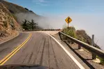
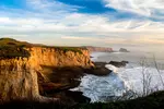
Foggy Weather on the Pacific Coast Highway
The coast around San Francisco and down through Big Sur is notorious for its misty weather. It usually forms in the morning and then slowly burns off as the day warms up. If you can delay your departure when it's foggy then do so, as it makes driving more dangerous and of course you won't get to see those fantastic Big Sur views.
If you have to drive when it's misty, put your headlights on low beam, take it slow, and pull over in the pull-offs whenever you can to have a break and check the conditions.
Fog isn't something you can avoid easily. On average, San Francisco gets just over 100 days a year on which some fog occurs, and another 100 or so when there's some cloud. Although the city has a reputation for fog and mist, it does in fact get fewer foggy and cloudy days than the average for large US cities. New Orleans is twice as foggy, for example.

Some of our driving pages
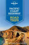
Pacific Coast Highway Road Trips: Lonely Planet Guidebook Review
Review of the Pacific Coast Highway Road Trips book from Lonely Planet, which includes a California Driving Guide, by the Pacific Coast Highway Travel website.
The 17-Mile Drive between Carmel, Pacific Grove, and Monterey
Pacific Coast Highway Travel takes the 17-Mile Drive from Carmel to Pacific Grove and Monterey, stopping to see the Lone Cypress and beautiful coastline views.
Driving the Pacific Coast Highway in Two Days
Pacific Coast Highway Travel's advice on driving the Pacific Coast Highway in two days, including the best places to stay, and the best things to do and see.
Ways to Go
Here are links to the different ways you can go along the Pacific Coast Highway, one of the most popular drives in the world but you can also cycle it.
Driving the Pacific Coast Highway in Three Days
Pacific Coast Highway Travel's advice on driving the Pacific Coast Highway in three days, including the best places to stay, and the best things to do and see.
Driving the Pacific Coast Highway in Five Days
Pacific Coast Highway Travel's advice on driving the Pacific Coast Highway in five days, including the best places to stay over, and the best things to do and see.
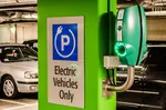
Washington Coast Charging Stations
Pacific Coast Highway Travel's guide to Washington coast charging stations for electric vehicles along Highway 101 from Oregon and around the Olympic Peninsula.
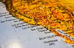
Maps of the Pacific Coast Highway: Free Driving Maps of the PCH
Road maps of the Pacific Coast Highway or PCH are essential for anyone planning to drive the trip, and detailed routes are available for free.
California Driving Laws
If visiting California and planning to drive the Pacific Coast Highway it's important to know California driving laws in case they differ from your own state.
Driving the Pacific Coast Highway
Driving the Pacific Coast Highway is made easier with Road Trip USA by Jamie Jensen, a good handbook for the west coast drive.
Route 66 Meets the Pacific Coast Highway
Historic Route 66 winds from Chicago to LA, going through Los Angeles, meeting the Pacific Coast Highway in Santa Monica, California, at the Santa Monica Pier.
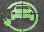
California Coast Charging Stations
California coast charging stations are so numerous that the Pacific Coast Highway is one of the best US road trips to drive in an electric vehicle or EV.
West Coast RV Parks
One of the best guides to West Coast RV Parks, covering campgrounds in California, Oregon, and Washington, is West Coast RV Camping from Moon Guides.
Pacific Coast Highway Drive Times and Distances
Drive times and distances on the Pacific Coast Highway or the quickest routes from Seattle to San Francisco to Los Angeles to San Diego.
Pacific Coast Highway in California
The Pacific Coast Highway in California book shows in historic photos the building of the Pacific Coast Highway from its earliest beginnings in 1911.
Drive the Pacific Coast Highway
Here are the basic facts if you plan to drive the Pacific Coast Highway, including which is the best direction and when is the best time to go driving.
Coastal California Guidebook
Lonely Planet's Coastal California guidebook is the ideal travel guide for driving or cycling the Pacific Coast Highway from the Oregon border to Mexico.
When to Drive the Pacific Coast Highway
When to Drive the Pacific Coast Highway depends on whether you want to drive in Oregon and Washington as well as California, and on the weather.
Best Time to Drive the Pacific Coast Highway
The best time to drive the Pacific Coast Highway is when you have the most time to spare, but late spring and fall is when you'll get the best weather.
LA to Hearst Castle
Pacific Coast Highway travel offers advice on driving from LA to Hearst Castle, including distance, journey time, and route.
Oregon Coast Charging Stations
Pacific Coast Highway Travel's guide to Oregon coast charging stations for electric vehicles, from Brookings in the south to Astoria in the north.
San Francisco to San Diego
Driving from San Francisco to San Diego has two main options, the fast way on I-5 or the scenic route along the Pacific Coast Highway.
Pacific Coast Highway Driving Tips
Pacific Coast Highway driving tips for this great American road trip include finding cheap gas, watching the speed limits, and allowing plenty of travel time.
Epic Drives of the World
Epic Drives of the World from Lonely Planet describes 50 of the world's most exciting road trips, including, of course, the Pacific Coast Highway.


Recent Articles
-
A rare slice of California coastline gets a preservation lifeline
May 02, 26 10:53 AM
Topanga Lagoon used to cover 30 acres. Now it's less than 1 acre in size. -
8 Hidden Oregon Coast Drives Off Highway 101 for a Chill Adventure
Apr 19, 26 12:16 PM
If you’ve driven along Highway 101 on the Oregon Coast, you know the views are stunning. But what if you want to explore some quieter, less traveled roads that still show off the beauty of the coast? -
15 affordable ways to explore the Pacific Coast Highway
Apr 19, 26 12:16 PM
Endless ocean views, rugged cliffs, towering redwoods, and charming coastal towns make the Pacific Coast Highway an unforgettable experience. With some planning, you can enjoy this iconic road trip wi…
FTC Disclosure: If you make a purchase via a link on this site, we may receive a small commission on the transaction - at no added cost to you. Thank you!
LATEST BOOKS
Take a look at our latest books: 101 Best Things to Do on the Pacific Coast Highway and 101 Budget Hotels along the Pacific Coast Highway. Click on the covers to learn more.


LATEST NEWS
Recent Articles
-
A rare slice of California coastline gets a preservation lifeline
May 02, 26 10:53 AM
Topanga Lagoon used to cover 30 acres. Now it's less than 1 acre in size. -
8 Hidden Oregon Coast Drives Off Highway 101 for a Chill Adventure
Apr 19, 26 12:16 PM
If you’ve driven along Highway 101 on the Oregon Coast, you know the views are stunning. But what if you want to explore some quieter, less traveled roads that still show off the beauty of the coast? -
15 affordable ways to explore the Pacific Coast Highway
Apr 19, 26 12:16 PM
Endless ocean views, rugged cliffs, towering redwoods, and charming coastal towns make the Pacific Coast Highway an unforgettable experience. With some planning, you can enjoy this iconic road trip wi…
As an Amazon Associate, we earn from qualifying purchases, but at no cost to you.
Buy an inexpensive journal to record your own Pacific Coast Highway adventure!

FOLLOW OUR PCH VIDEOS ON YOUTUBE
The Best PCH Guide
We've read lots of guides to the Pacific Coast, and easily the best one is the Moon Handbook. You can read our review here, or buy it through the Amazon link below.

No words or images to be used without prior permission.
We do not sell personal information: see our Privacy Policy.
California Consumer Privacy Act - CCPA: Sale Of Personal Information
Pacific Coast Highway Travel does not sell any information it gathers for any reason. It has not collected or sold any personal information in the last twelve months or ever in the past.
This website was built using Site Build It!