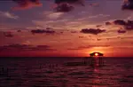
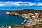
Point Reyes National Seashore
The Point Reyes National Seashore is an hour’s drive northwest of San Francisco on the Pacific Coast Highway and is maintained by the National Park Service.

The national seashore is actually a peninsula, the Point Reyes Peninsula, which is separated from the mainland by Tomales Bay. The bay is about 15 miles (24 km) long and was formed because it is part of the San Andreas Fault, which runs through California.
Our Pick of the California Guides

Where is the Point Reyes National Seashore?
The Point Reyes National Seashore is in Marin County, California, about an hour’s drive northwest from San Francisco, across the Golden Gate Bridge and along the Pacific Coast Highway. You go through Stinson Beach and eventually reach the tiny community of Olema, where you’ll find the Visitor Center for Point Reyes.
 Map (c) Google Maps
How Big is the Point Reyes National Seashore?
The Point Reyes National Seashore covers an area of 71,028 acres, or 111 square miles (287 sq kms). It has 100 miles (161 kms) of shoreline. It was created in 1962 and is designated as both a national seashore and a park preserve, and is maintained by the National Park Service.

What to Do at the Point Reyes National Seashore
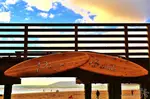
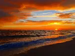
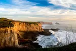
The seashore has beaches that have been voted the cleanest in California. There are plenty of trails, so get yourself a good map or get information at the Visitor Center. There are estuaries, headlands with dramatic views, a lighthouse, a lifeboat station, and uplands too – it isn’t all at sea level! The highest point is Mount Wittenberg, which is 1,407 feet (429 meters) high.
Kule Loklo
Close to the Visitor Center you can visit Kule Loklo, which is a recreated Coast Miwok village, the Coast Miwok being the indigenous people who originally lived around Point Reyes, in Marin County, and in Sonoma County.

Wildlife at the Point Reyes National Seashore
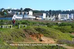
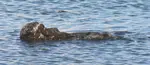
If you like wildlife you’ll love Point Reyes, especially if you’re a keen birdwatcher. In all, some 45% of all bird species in the whole of North America have been seen at the Point Reyes National Seashore. At the northern end of the peninsula is a reserve of tule elk, a species of elk that is only found in California. You can also see seals, elephant seals, and see whales offshore when they are migrating.
Best Time to Visit Point Reyes National Seashore
You can visit Point Reyes all year round, but spring is a good time to see the best of the wild flowers. Most rain falls from November to April, with the summers fairly dry. From June to October the average maximum temperature is in the 70s (over 21C), while in winter it can fall to near freezing.

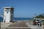
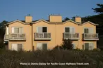
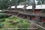
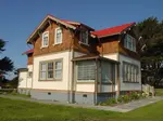
Where to Stay at Point Reyes
More Information
Visit the official National Park Service website for the Point Reyes National Seashore.
Other California coast pages
Dana Point
Dana Point in California is the official start or end of the Pacific Coast Highway, and its attractions include whale watching, and Doheny State Beach.
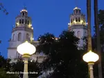
Visiting Hearst Castle
This Visiting Hearst Castle page gives all the practicalities including location, types of tour, length of tours, how long to allow, and much more information.
Laguna Beach Inn and Spa
The Casa Laguna Hotel and Spa in Laguna Beach is right on the Pacific Coast Highway and has luxury rooms, a swimming pool, and real gourmet breakfasts.
Pelican Inn and Suites in Cambria on the Central Coast of California
The Pelican Inn and Suites in Cambria on California's Central Coast has oceanfront views, swimming pool, gardens, and is right on the beach near Hearst Castle.
Stanford Inn by the Sea Mendocino
The Stanford Inn by the Sea in Mendocino on the California coast is an eco-resort with yoga classes and the award-winning Ravens Restaurant.
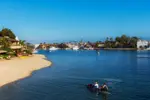
Pismo Beach
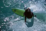
Pismo Beach is a small beach town on California's Central Coast, a resort famous for surfing and clams.
Carlsbad
Carlsbad is a beach city north of San Diego in southern California famous for its flower fields, LEGOLAND resort and water park, surfing and SEA LIFE Aquarium.
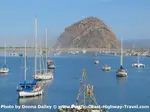
Morro Bay
Morro Bay is a delightful small town on the California coast roughly halfway between San Francisco and Los Angeles and noted for the huge Morro Rock.
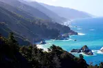
Scenic Spots on the Pacific Coast Highway
Pacific Coast Highway Travel's guide to the most scenic spots on the Pacific Coast Highway in California with Big Sur, Bixby Bridge and Pfeiffer Beach.
San Simeon
San Simeon is a tiny town of a few hundred people close to Hearst Castle on the California coast midway between San Francisco and Los Angeles.
Coastal California Guidebook
Lonely Planet's Coastal California guidebook is the ideal travel guide for driving or cycling the Pacific Coast Highway from the Oregon border to Mexico.
Newport Beach
Newport Beach is a small city on the Pacific coast of southern California, right on the Pacific Coast Highway and noted for its beaches and surfing.
Best Time to Visit Mendocino
PCH Travel picks the best time to visit Mendocino, with a monthly summary of the weather, plus hotel prices and special events to help plan a visit.
Free Things to do on the Pacific Coast Highway
There are lots of free things to do on the Pacific Coast Highway and here's our list of ten of them including wildlife, the best free views, and free museums.
Santa Catalina Island
Santa Catalina Island, or Catalina Island, is off the shore of Southern California and reachable from Long Beach, San Pedro, Newport Beach, and Dana Point.
Mendocino
Mendocino in Mendocino County is a small but pretty California coastal town, popular with artists and with travelers. It has featured in many songs and movies.
Pacific Grove
Pacific Grove is a small city on the California coast, next to Monterey and close to Carmel, with attractions including its historic Victorian houses.
Santa Monica, California
Santa Monica in California is famous for its pier, and beaches, and is one of the best west coast vacation spots, with hotels, restaurants, surfing, museums.
Santa Cruz
Santa Cruz on the Pacific Coast Highway in California has its famous boardwalk, beaches, wine tastings, Surfing Museum, Mission, and Marine Discovery Center.
Top Wildlife Spots on the California Coast
Pacific Coast Highway Travel recommends some of the top wildlife spots along the California coast.
Unique Inns on the Pacific Coast Highway
Unique Inns on the Pacific Coast Highway include some of the best independently-owned boutique hotels, spas, and lodges in California, Oregon and Washington.
Santa Barbara
Standing on the Pacific Coast Highway in California, Santa Barbara is an attractive resort with a historic downtown, sandy beaches, a mission, and good museums.
Lighthouse Inn at Point Cabrillo
The Lighthouse Inn at Point Cabrillo is a romantic, historic guesthouse on the Mendocino California coast, on the Pacific Coast Highway.
La Jolla, in southern California
La Jolla in southern California is north of San Diego off the Pacific Coast Highway and has museums, restaurants, hotels, beaches, and the Birch Aquarium.
Moss Beach Hotel
For a Moss Beach hotel just off the Pacific Coast Highway, the Seal Cove Inn offers good accommodation north of Half Moon Bay, minutes from the ocean.


Recent Articles
-
I've taken over 20 Amtrak routes around the US and Canada. These 5 offered the most stunning views.
Mar 13, 26 11:58 AM
For travelers who love calming ocean views, I recommend riding the Amtrak Coast Starlight from Los Angeles to Seattle, which takes about 34 hours. I thought the first day of the trip was the most scen… -
The World’s Greatest Places of 2026: Highway 1
Mar 13, 26 11:58 AM
California’s epic coastal route, Highway 1—also known as the Pacific Coast Highway—reopened in its entirety on January 14, restoring one of the great American road trips. Stretching roughly 655 miles… -
When to Visit California for the Best Experience
Mar 09, 26 11:31 AM
Discover the best time to visit California by season and region, balancing weather, crowds, prices, and special events to match your ideal trip.
FTC Disclosure: If you make a purchase via a link on this site, we may receive a small commission on the transaction - at no added cost to you. Thank you!
LATEST BOOKS
Take a look at our latest books: 101 Best Things to Do on the Pacific Coast Highway and 101 Budget Hotels along the Pacific Coast Highway. Click on the covers to learn more.


LATEST NEWS
Recent Articles
-
I've taken over 20 Amtrak routes around the US and Canada. These 5 offered the most stunning views.
Mar 13, 26 11:58 AM
For travelers who love calming ocean views, I recommend riding the Amtrak Coast Starlight from Los Angeles to Seattle, which takes about 34 hours. I thought the first day of the trip was the most scen… -
The World’s Greatest Places of 2026: Highway 1
Mar 13, 26 11:58 AM
California’s epic coastal route, Highway 1—also known as the Pacific Coast Highway—reopened in its entirety on January 14, restoring one of the great American road trips. Stretching roughly 655 miles… -
When to Visit California for the Best Experience
Mar 09, 26 11:31 AM
Discover the best time to visit California by season and region, balancing weather, crowds, prices, and special events to match your ideal trip.
As an Amazon Associate, we earn from qualifying purchases, but at no cost to you.
Buy an inexpensive journal to record your own Pacific Coast Highway adventure!

FOLLOW OUR PCH VIDEOS ON YOUTUBE
The Best PCH Guide
We've read lots of guides to the Pacific Coast, and easily the best one is the Moon Handbook. You can read our review here, or buy it through the Amazon link below.

No words or images to be used without prior permission.
We do not sell personal information: see our Privacy Policy.
California Consumer Privacy Act - CCPA: Sale Of Personal Information
Pacific Coast Highway Travel does not sell any information it gathers for any reason. It has not collected or sold any personal information in the last twelve months or ever in the past.
This website was built using Site Build It!